
Tasman High Last Week of June

I've mentioned the possibility for E'ly swell building into the weekend of the 2/3rd July in my extended notes from this high, but at this stage it's a bit of a long shot.
Until then there's nothing special on the cards for Sydney besides a couple of fleeting pulses of S'ly swell over the next few days..
I hear ya Steve and I'm praying, but given Access' track record, one would have to think its a real long shot.
That last Access-G chart put a chill up my spine.
Specially when I looked at the date.
Its showing some pretty amazing tropical developments for this time a year. Surely it can't come to fruition?
And just like that, Access G has gone off the boil.
What was the significance of the date in your reply above Steve?
Let's hope the EC charts come to fruition with the low off the NE tip of that sheep shaggin isle, although from previous experience the low usually sneaks behing the isle before it deepens....but fingers crossed anyway!!!
Feck me, it's getting to the desperado stage now!!!
God I hope that compact fetch off the west coast of that sheep shaggin isle comes to fruition mid this week, otherwise we're in trouble!!! Need that local synoptic wind to bugger off after that also.....dont' want no locally generated crappy windswell messing with my E/SE groundswell.

That swell began on 6th July, I think. Is that the date you're thinking of?
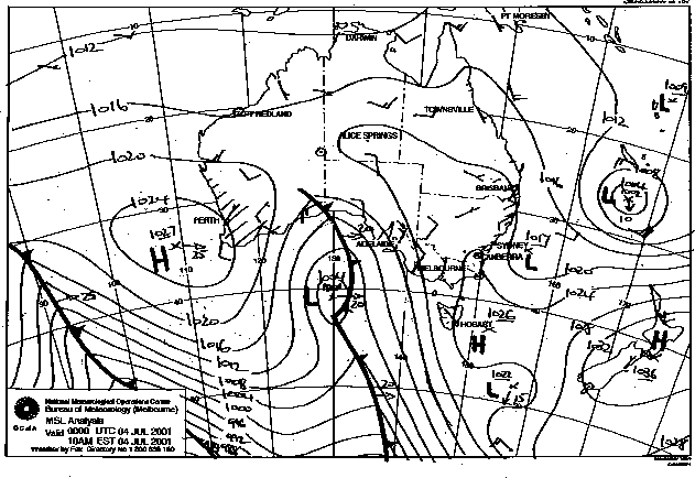
10 years to the day since the great E swell of July 2001.
By: "freeride76"
But it's still June at the moment Steve??
The swell began a week before here and peaked on Sat July 7 at a clean 8-12ft.
We had a week of 4-6ft surf leading up to that date.
Yes, but we are talking about a pattern that would have seen surf in the first week of July.
The swell began a week before here and peaked on Sat July 7 at a clean 8-12ft.
We had a week of 4-6ft surf leading up to that date.
By: "freeride76"
You sure?
Yeah.
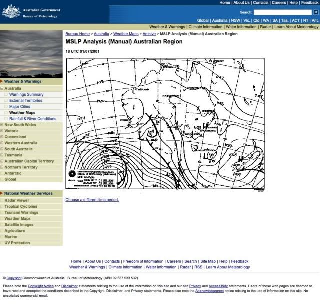
This precursor tradewind fetch off the North Island doesn't look much on the BOM charts but it and the offshore trough gave a slowly building E swell starting from MOn 2 July.
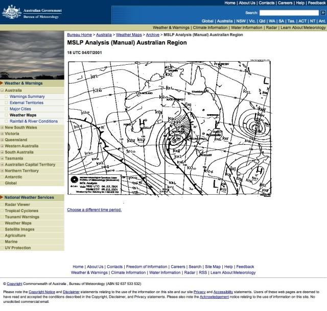
Here's the storm at it's peak....with the massive clean E swell met by that approaching front.
So whilst it's nice to dream about the past, let's get back to reality. I see from your forecast today Steve, that there's no mention of the potential small trough of low pressure on the northern flank of the Tasman high late this week and into the weekend (with a closed low potentially stalling out near NZ) as progged by both EC and ACCESS G. Does that mean you're favouring the GFS charts instead?
In fact looking at most of the other models (NOGAPS, CMC etc) GFS appears to be the only outlier with no real low pressure developments out near NZ later this weekend.
Finally, GFS is now on board with the other models. Good news is, swell forecast is on the up. Bad news is, it's just fecked my open beaches session this weekend (with winds looking unfavourable). Crowds will be horredously thick on the points given our long flat spell!!! :(
That's a pretty impressive Tasman high (1035+ hPa) scheduled to push into the Tasman next week. Just a shame it's latitude isn't further south. Let's hope it's eastward progresion also slows as it hits around NZ longitudes!!!
Cause without it, there's SFA to surf otherwise (in SE Qld).