
Big east swell for queensland?

Oh shit, I think I have no holiday time left.
Better start coughing and faking a puke every now and again.

^^ Sorry Clif, three weeks in Bali and one in Barcelona means you get no sympathy from me!
Just quietly though, GFS is showing a tightly wound Tasman onion sprouting next Monday, which would mean south swell for Sydney. Might not be any need to bolt north.
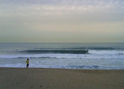
Not me. Photo from a welsh friend who bodysurfs. He is at Barcelona Uni, where I went. He says it gets double that. I just missed a nice swell on 10th January. See for yourself:
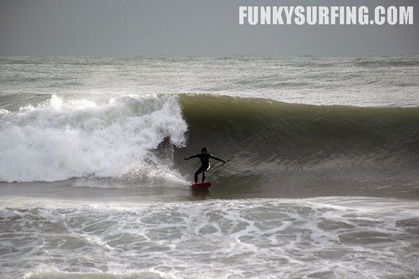
via Funkysurfing.com
Long-range GFS charts have been showing the swell of the century, with a huge tropical low near New Cal and a massive cradling high to the south. I don't have a huge amount of faith in anything out that far (beyond 7 days).
The end of the EC run and the 7 day GFS are both showing a tropical low/cyclone near Fiji/Solomon Islands mid to late next week, although too early to say how good this will turn out to be. There's definitely some promise in terms of swell for Qld around the weekend of the 20th/21st(and beyond), but I wouldn't be putting any figures on wave heights yet. One to watch though.
^^^looks like the forecast has changed already alex. still a bit of activity but not looking as dramatic
it would be dramatic if i lernt the chemical chart and invented a low pressure system BOM, ide drop it 3500 kls off shore with a fetch to the aquired destination it would be 15ft, and offshore due the approaching trough, swell peeking after lunch...(sorry i cant spell)(im serious i cant)
Should have recovered from the last round by then! Kirra was off the planet during the week and not very crowded even on Sat/Sun when it was still pumpin. Too old to be surfin 5-6 hours a day :-(
But bring it on .... not too big..... just 5-6' like last week :-)
Looking good for an increase by Saturday morning, we might see some varriable winds early on in the piece before that prevailing Sou'Eatser is back. I think it could be really on for the southern Points since the bank build up last swell, last week.
Swell actually looks to peak on Friday, more than likely around lunch time with some serious punch in swell period (for SE Qld). Expect long waits for the sets, but when they arrive, one will be wanting a larger board for the paddle in and take offs as these waves will be travelling at speed.
Swell and period both look to die off somewhat come Saturday morning, just in time for the frothing masses. I wouldn't be expecting SW/S winds on Saturday morning for the greater part of the Goldy either, perhaps only down around the Cooly stretch at best.
Sunday should see a new pulse of mid range E/SE swell, peaking more so into Sunday lunchtime/afternoon, but it will have nothing in terms of power and well aligned lines compared with what is likely to grace our shores come Friday.
Forerunners are already showing up on the GC wave buoy.....possibly slightly ahead of schedule so we could start to see some nice lines after lunch today!!!!
theres a feeling in the air! and theres crowds in the surf!
sound the bells, cyclone comin!
Forerunners are already showing up on the GC wave buoy.....possibly slightly ahead of schedule so we could start to see some nice lines after lunch today!!!!
By: "donweather"
I made a note of this in my forecast regarding whether or not the highest wind speeds were fed into the WW3 models and their ability to resolve such a tight and powerful system. If they didn't, we could see the swell arrive earlier than expected. We'll see when it hits Sydney!
Yeah I read that in your synopsis Craig. Although according to Mr Shearer, there was no sign of any forerunners at his local break today so I'm a little bemused at the readings on the GC Wave Buoy. Sydney and Coffs Buoys aren't showing any signs of the forerunners as we speak either............hoax swell perhaps? ;)
17 seconds at the GC Wave Buoy now.......not every day we see these swell periods from the east in SE Qld!!!
There was at least 5-10 minutes between proper sets this arvy. Bits and bobs in between, but when they came through you could see the difference in swells.
So you reckon there was still some leftover remnant TC Rene swell this arvo Bill?
anyone noticed the system forecast to move into our swell window late next week?
care to speculate?
if it comes off it looks like it'll be a huge swell. unlike a lot of tc's it's a long way off the queensland coast. no wind!