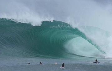
Gabrielle Gives The Cold Shoulder
East Coast surfers would have at least witnessed, if not felt, the power and energy from Tropical Cyclone Gabrielle and its extra-tropical transition north of New Zealand.
A lot of energy was expelled to produce three days of large, powerful surf that fanned out across three states.
Where does all the energy come from to feed a significant storm like Gabrielle?
Looking at the sea surface temperature charts following the passage of Gabrielle, the answer is quite obvious.
A clear and significant cooling trend has occurred throughout the Coral Sea, dropping 3°C from before and after the transition south of New Caledonia.
The track, from just south of the Solomon Islands (where it developed into a tropical cyclone), is also apparent, as well as the loss of heat north of New Zealand as the extra-tropical system stalled earlier this week.

Tropical cyclones feed off the energy provided by warm sea temperatures directly underneath them, in an exchange called the air-sea latent heat flux.
Ocean surface water evaporates into the atmosphere, rising and then condensing which results in the release of heat. This further feeds convection, resulting in increasing wind speeds, increasing evaporation and further latent heat exchanges.
It's a classic positive feedback loop, occurring only when sea surface temperatures are above 26.5°C and when the mixed layer (depth of the warm sea temperatures) is of significant depth.
The stronger the tropical storm, the more energy it uses, and this results in a drop in the sea surface temperature, as shown in the images above. Localised upwelling also plays a small part to the cool signal following a tropical storm.
Phytoplankton blooms can also occur following the cooling and upwelling of deeper nutrient rich water, with one such bloom taking place off an atoll sitting half way between New Caledonia and Australia.

Before and after aatellite imagery showing phytoplankton bloom in the wake of Gabrielle. 6th February (left), 11th February (right)
The cool water signal will likely persist for a few weeks before mixing back with the ambient sea water. In the short term, the cooler water suppresses any significant tropical developments in the area thanks to the lack of available heat energy.


Comments
Is this bloom similar to the one near the Coorong in SA recently Craig? The water was so unusually warm in NZ this summer. I never wore boardies at Raglan growing up
Looks like it! But without actual specimens hard to confirm.
Wow, thats an amazing cool SST signal left behind.
Meanwhile the beach water temp in the macleay area is over 27deg
I remember Yasi left a large cool track through a very warm sea years ago too.
Indeed! https://www.swellnet.com/news/swellnet-dispatch/2011/02/15/yasi-paints-…
Hey Craig, the swell hit tassie late Monday night, was good Tuesday - dwindled through wednesday
Yep, a day later down your way. The lines and quality looked great! Get a couple?
it was a beautiful swell, and the winds were lite, so amazing day ... in answer: not as many as i would have liked!
Nice one, Craig.
Not so much related to what you describe, but Gabrielle sure made herself felt on our SSTs here on the North Island west coast. Two days of very strong W to SW winds drove significant upwelling, and I reckon our inshore water has dropped 3 to 4C.
Should recover a little the next few days.
Great info as always Craig.
New Zealand’s East Coast of the North Island has been devastated in many parts by this weather system and images coming out of NZ are shocking. Hawkes Bay, Gisborne, Coromandel all hammered badly. Still no power, no water supply, no communication, no home, for many nothing left. There is a satellite image of last Sunday at dawn showing Gabrielle totally engulfing most of NZ. It was an absolute monster!
Tough weeks and months ahead for many in NZ, as many in Australia will know firsthand with floods and fires over the last few years. Take care all!
1 & half quality days off TC Gabe before the onshores destroyed any quality on Tuesday as the swell started to wane. Sunday arvo & Monday all day @ a Novelty reef break but unfortunately missed the Monday due to work commitments.TC Gabe moved very quickly in & out of our swell window.