
Building swells this week

Southern Tasmanian Forecast by Craig Brokensha (issued Monday November 10th)
Best Days: Wednesday, Thursday morning, Friday and Saturday mornings
Features of the Forecast (tl;dr)
- Small W/SW swell for tomorrow with NW tending W/NW then SW winds
- Moderate sized W/SW swell building Wed with strengthening NW tending W/NW winds
- Easing swell Thu with strong N/NW tending W-W/SW winds
- Moderate + sizied S/SW swell Fri with W/NW winds ahead of strong S/SE sea breezes
- Easing swell Sat with similar winds to Fri, N/NW Sun
Recap
The weekend started poor and onshore, improving through yesterday morning with lighter offshore winds and some fun swell.
Today, conditions started small and onshore, but winds have since gone more offshore with an increase in swell to 2ft.
This week and weekend (Nov 11 - 16)
We’ve got an active week of surf ahead thanks to flurry of strengthening Southern Ocean frontal activity moving in from the west over the coming days.

Firstly tomorrow, some new mid-period W/SW swell is due to build through the day, generated by a weak but healthy frontal system that’s currently west-southwest of us.
Surf to 2ft+ is generally expected with a morning NW tending W/NW then SW breeze into the afternoon.
Of greater significance is a deepening low moving in through tomorrow and Wednesday, generating fetches of W/SW gales before stalling under us Thursday, projecting a fetch of additional S/SW gales through our southern swell window.
This should see building levels of mid-period W/SW swell through Wednesday, easing Thursday followed by S/SW energy Friday.
Clifton should build to 3ft through Wednesday afternoon with strengthening NW tending W/NW winds, easing back from a similar size Thursday with strong N/NW morning winds, shifting W-W/SW into the afternoon.

Friday looks the biggest size wise with surf to 3-4ft along with morning W/NW offshores ahead of strong S/SE sea breezes.
Easing surf is due through the weekend with a morning W/NW offshore on Saturday ahead of sea breezes, N/NW all day Sunday but tiny.
Longer term the models diverge but we could see renewed frontal activity through next week and plenty of westerly swell if it goes the European, ECMWF’s way. More on this through the week.
Latest news
US Surfing Gets Certified, Again

'Southern Edge' Tour Dates
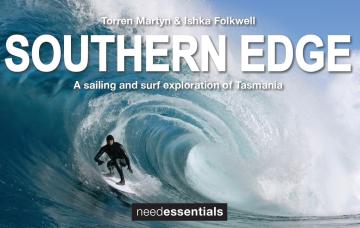
A sailing and surf exploration of Tasmania.
2026 Margaret River Pro: Day 2

"Surfing IQ was at a premium: navigating warped, wobbly, yet sizable chunks of water."
2026 Margaret River Pro: Day 1
A day when too much pro surfing was...too much.
Forecast: 2026 Margaret River Pro
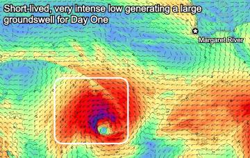
We're set for a cracking opening day of the waiting period before onshore winds set in.
Trouble Shooter // The Five Fin Surfboard
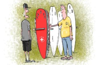
Muzz explains the "each way bet" shapers have when they throw five fin boxes into a board.
A Return To Caloundra Bar?

Hoping to stop erosion, authorities are dredging Bribie Island, but will the bar ever return?
Comments
What's up with the model divergence?. Forecast model saying 2ft but written forecast saying 3-4ft. Have noticed it happening lately.
For Friday? Latest updates have 2-3ft by the model, but it's showing the swell coming in more west than south. It's one of the downfalls of the current algorithm which has been improved in the latest version that's close to launch.
Rogey, thanks for the response