
More quick fire S swell spikes and NE windswells this week- possible pattern change on the radar

South-east Queensland and Northern NSW Forecast by Steve Shearer (issued Mon Nov 10th)
Features of the Forecast (tl;dr)
- Easing S swells Tues with light winds tending NE in the a’noon
- Another flush of S swell Wed favouring south of the border for size with fresh SW-S winds, easing through the a’noon
- N’lies increasing later this week with NE windswell favouring south of Yamba
- Stronger long period S groundswell this weekend but N’lies a problem
- Dynamic week on the radar next week- low confidence in specifics so check back Wed for latest
Recap
Howling N-NE winds Sat didn’t offer much except a 2ft wave at the backbeaches, although there was more size south of Yamba. Sunday was much calmer with light winds around a stalled trough and mostly tiny surf in the 1ft range or less. S swells have shown unevenly today with the Far North Coast and Gold Coast magnets showing 3-4ft and 2-3ft surf respectively while areas to the south are much smaller and seemed to have been bypassed by the swell. Light winds and rain today are keeping surface conditions relatively smooth.

Short range S swells building into SEQLD
This week (Nov 10-15)
A front and trough have moved rapidly through the Tasman after bringing a S’ly change and spike in S swell. Weak high pressure moves into the sub-tropics before another rapid-fire S change and subsequent S swell spike Tues/Wed, with a return to N’lies for the rest of the working week into the weekend. A low traversing below Tasmania later this week now looks weaker than Fri’s expectations but will still provide some S’ly groundswell over the weekend.
In the short run S swell will be on the way down tomorrow with leftover sets to 3ft early at S facing beaches in NENSW, smaller 2ft in SEQLD at S magnets, decreasing through the day. S magnets should see the best of it with light W winds, tending variable then mod N-NE in the a’noon.
An o/night/early morning fresh and gusty SW-S change and the fetch of strong S’lies in the Tasman whips up another spike in short range S swell for Wed- with size building to 3-5ft across NENSW S exposed breaks, smaller 2-3ft in SEQLD at S facing beaches. Fresh and gusty S’lies will tend S/SE-SE and ease through the a’noon.
 Easing quickly through Thurs with leftovers around to 3ft at S facing beaches in NENSW, 2ft in SEQLD and some traces of longer period swell in the mix. Early winds will be lighter NW but will swing N’ly-N/NE’ly and freshen as is the seasonal norm.
Similar winds on Fri. A trough looks to wander north along the NSW south and central coast with EC suggesting it reaches the Hunter/lower MNC before stalling, potentially just sneaking into the Port Macquarie- Coffs stretch. GFS suggests the trough staying further south with N’ly winds Fri and some small NE windswell. Flukey long period S swell wrap will be worth having a look at local S swell magnets for stray sets but better odds for Sat.
This weekend (Nov 16-17)
N’ly winds expected this weekend as a cut-off low approaches from the SE interior- early NW winds tend N’ly and freshen. NE windswell looks to build again, favouring spots south of Yamba and building to 3ft. We should see another better angled pulse of S’ly groundswell arrive late Sat or early Sun with sets to 3ft at S magnets.
 N’lies again Sun, although likely to wash out on the MNC-Coffs as a trough tickles the area. Light/variable winds are possible there, with a mix of NE windswell and S’ly groundswell offering some 3ft sets. Further north N’ly winds and less NE windswell with not much S swell getting north of the border.
Next week (Nov 18 onwards)
We may see a more dynamic pattern unfold next week with GFS modelling an E’ly infeed into an approaching inland trough/low which has potential for a weather/surf event, although run to run model consistency is still poor at this stage.
EC holds a weak, troughy pattern until later next week with a stronger high holding a more southerly position and setting up a strong ridge and deep SE’ly flow through the Tasman and up into the Coral Sea. We’d see building surf into next weekend under that scenario, with winds favouring the points.
 Both those scenarios suggest a loosening of the spring stranglehold of mobile weak highs and minor NE windswells.
To the east models are suggesting a potential long-lived trade wind event, with embedded lows. While travel distance tends to shave off most of the size, we'll flag it now with the view for a background E swell to start to build medium term.
Let’s see how it looks Wed.
Seeya then.
Latest news
US Surfing Gets Certified, Again

'Southern Edge' Tour Dates
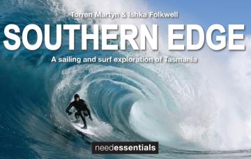
A sailing and surf exploration of Tasmania.
2026 Margaret River Pro: Day 2

"Surfing IQ was at a premium: navigating warped, wobbly, yet sizable chunks of water."
2026 Margaret River Pro: Day 1
A day when too much pro surfing was...too much.
Forecast: 2026 Margaret River Pro
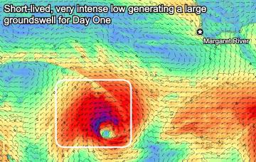
We're set for a cracking opening day of the waiting period before onshore winds set in.
Trouble Shooter // The Five Fin Surfboard
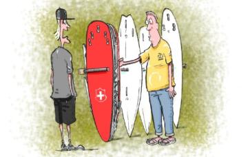
Muzz explains the "each way bet" shapers have when they throw five fin boxes into a board.
A Return To Caloundra Bar?

Hoping to stop erosion, authorities are dredging Bribie Island, but will the bar ever return?
Comments
Still way OH this a'noon but straight onshore crud with rain.
Feels like we've been Ground Hogged back to Autumn where every swell came with a coastal trough, onshores and rain.
Never seen an entire year here without an A-grade day, but it looks like this year will win that dubious distinction.
No sand on the points and no signs of any change there. Thats well over a year now with crap sand and entire surf breaks that are functionally extinct.
Same for the surrounding points just south?