
NE windswells, spikes of S swell and a better quality S swell now on the radar

Sydney Hunter Illawarra Forecast by Steve Shearer (issued Fri Nov 7th)
Features of the Forecast (tl;dr)
- Fun NE windswell event Fri PM, peaking Sat with winds shifting NW Sat PM as low approaches (watch for lighter winds around a trough midday)
- S’ly change o/night with SW-S winds Sun and S swells building in the a’noon
- S swell peaks Mon AM with winds moderating and becoming light
- Small leftovers Tues with offshore winds and a S’ly change
- Small flush in S swell Wed with light winds
- Potential for stronger, long period S swell Fri/Sat, easing sun- check back Mon for latest updates
Recap
Small S swells in the 2ft range (2-3ft on the Hunter) were the main energy in the water yesterday with some clean conditions on offer early under light/variable land breezes before NE winds kicked up. Workable NE windswells are on offer today, mostly in the 2ft range with the occ. bigger set and we should see a little more size build in through the day, with freshening N/NE winds as an accompaniment.

Rideable NE windswell on offer
This weekend (Nov 8-9)
No great change to the weekend f/cast. Weak high pressure in the Tasman with an increasing N-N/NE infeed into an approaching cut-off low and trough system. A proximate fetch of N’lies sees NE windswell continue to build in o/night with size in the 3 occ. 4ft range through the morning, under an easing trend by mid-late morning as the fetch moves away to the east. Local winds should be N/NW to N through the morning, with winds dropping out around lunch-time around the trough line, before swinging more NW as a front pushes through. A SW-S change now looks to push into Sydney around dark or just after - but keep eyes on local winds through the late arvo.
Fresh and gusty W/SW- SW tending S’ly winds Sun as the cut-off low moves off the coast. It moves away quickly so winds should tend S/SE and moderate quickly later in the a’noon. A steep spike in S swell is expected after an undersized start with 2-3ft surf building to 4-5ft short range S swell through the a’noon. Keep expectations pegged pretty low as far as quality goes.
 Next week (Nov 10 onwards)
A very weak ridge Mon quickly breaks down as high pressure moves NE into the Tasman. That should see light offshores breezes in the morning tending to NE winds which freshen in response to the approach of a cold front. The morning looks good with mid period S-S/SE swells in the 4ft range easing through the day as winds kick up. Nothing amazing but worth pouncing on this time of year.
Small leftovers to 2ft at S facing beaches Tues but winds swing offshore as the front passes over so worth a look. Expect offshore W/NW tending W’ly winds swinging fresh S’ly as a high pressure builds in quickly behind the front.
That ridge then eases quickly Wed as a weak high cell moves NE into the Tasman, with light land breezes tending N-NE at fresh paces in the a’noon. Some workable S swell from the front in the 3ft range offers a fun wave at S facing beaches. It’s just a quick up and down, gone by Thurs so get in Wed for a shred.
Another frontal system linked to a deep low passing under Tasmania approaches later next week (see below). Still too early to have much confidence in specifics but at this early stage indications are of a swell of much greater quality as the parent low and gales become slow moving and the system intensifies.
 We’ll look at size and timing on Mon but we should see an initial pulse build in Fri then a stronger, longer period swell Sat, potentially up in the 5-6ft range at S facing beaches and some outliers on the reefs. Winds look light during this time.
Check back Mon for the latest on this swell and in the meantime, gave a great weekend!
Latest news
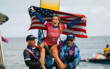
US Surfing Gets Certified, Again
'Southern Edge' Tour Dates
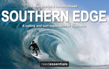
A sailing and surf exploration of Tasmania.
2026 Margaret River Pro: Day 2
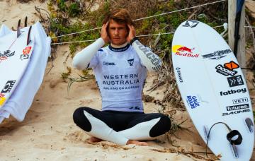
"Surfing IQ was at a premium: navigating warped, wobbly, yet sizable chunks of water."
2026 Margaret River Pro: Day 1
A day when too much pro surfing was...too much.
Forecast: 2026 Margaret River Pro
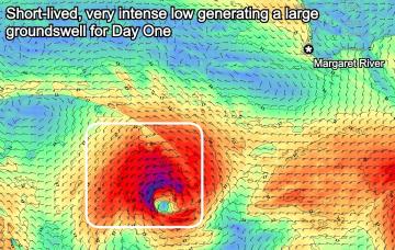
We're set for a cracking opening day of the waiting period before onshore winds set in.
Trouble Shooter // The Five Fin Surfboard
Muzz explains the "each way bet" shapers have when they throw five fin boxes into a board.
A Return To Caloundra Bar?

Hoping to stop erosion, authorities are dredging Bribie Island, but will the bar ever return?
Comments
Late saturday arvo on the NW wind shift, surfed with 3 others. Caught everyone off guard, gorged ourselves, low tide, 2-3ft, so fun.
Nice one.