
Great mid-late week

Victorian Forecast by Craig Brokensha (issued Monday November 10th)
Best Days: Wednesday, Thursday morning
Features of the Forecast (tl;dr)
- Moderate sized mix of weak swells tomorrow with fresh W-W/SW tending strong SW winds
- Moderate + sized mid-period W/SW tending SW swell building Wed (peaking later) with strong W/NW winds, easing later
- Easing swell Thu with N/NW tending W/NW then strong S/SW winds later
- Moderate sized, mid-period S/SW swell Fri with moderate S/SE-SE winds, strengthening into the PM
- Easing surf Sat with fresh S-S/SW winds
- Small leftovers Sun with N/NW-NW tending W/NW winds
- Active outlook next week
Recap
The weekend was terrible with strong onshore winds, easing a touch through yesterday but with nothing to work with.
Today, conditions have improved across the Surf Coast with some building mid-period S/SW swell that should reach 2-3ft through the day but with a shift in winds to the SW later afternoon.
This week and weekend (Nov 11 - 16)
We’ve got an active week of surf and swell ahead with strengthening Southern Ocean frontal activity due to be projected up and towards us over the coming days, migrating slowly east later in the week and into the weekend.
Firstly, a building mid-period SW swell due through today will be topped up by a better increase in energy through tomorrow, produced by a broad fetch of strong SW winds currently south of the Bight.
The front generating the swell will move in overnight, bringing some windswell to the mix, but we should see the Surf Coast coming in around 3ft (odd bigger one magnets) with 4-5ft surf to the east.
Conditions unfortunately look average thanks to the swell generating front sweeping through, bringing fresh W/SW tending strong SW winds, and a spike in windswell through the afternoon.
The Surf Coast will likely see periods of W’ly winds through the morning but with raw, lumpy conditions.

Wednesday looks much, much better thanks to a flurry of stronger frontal activity pushing right up and into us, with the first and most robust system due to form south of the Bight early tomorrow, projecting a great fetch of W’ly gales towards us, with a low pressure centre likely forming just as the system approaches Tasmania.
A good, moderate sized mid-period W/SW tending SW swell is due from this source Wednesday, building to a peak through the afternoon before easing Thursday.
The Surf Coast should build towards 4-5ft+ with 6ft to nearly 8ft sets to the east as strong W/NW winds create clean conditions, easing off from late afternoon.
The low is due to stall a little into Thursday, directing a persistent fetch of strong to near-gale-force SW winds through our south-western then southern swell windows generating some great reinforcing levels of mid–period S/SW swell later week.
The stalling nature of the low will also bring N/NW winds to the region early Thursday morning (shifting W/NW though the day ahead of a late S/SW change) with easing sets from 3-5ft on the Surf Coast, 6ft+ to the east, while Friday looks onshore as winds shift S/SE-SE.
Size wise, the Surf Coast should still be 3-4ft on Friday with 5-6ft sets to the east, easing into the weekend as winds shift back more S’ly and increase.
Sunday looks better as an incoming mid-latitude low swings winds back to the NW but swell wise, we’re only looking at small leftovers following the easing trend from Friday.
Longer term the models diverge but we could see renewed frontal activity through next week if it goes the European, ECMWF’s way. More on this through the week.
Latest news
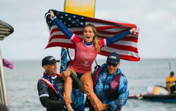
US Surfing Gets Certified, Again
'Southern Edge' Tour Dates
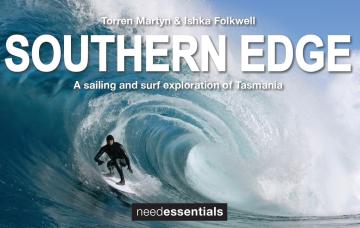
A sailing and surf exploration of Tasmania.
2026 Margaret River Pro: Day 2
"Surfing IQ was at a premium: navigating warped, wobbly, yet sizable chunks of water."
2026 Margaret River Pro: Day 1
A day when too much pro surfing was...too much.
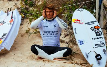
Forecast: 2026 Margaret River Pro
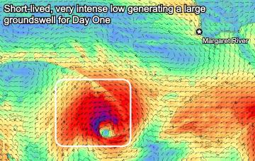
We're set for a cracking opening day of the waiting period before onshore winds set in.
Trouble Shooter // The Five Fin Surfboard
Muzz explains the "each way bet" shapers have when they throw five fin boxes into a board.
A Return To Caloundra Bar?

Hoping to stop erosion, authorities are dredging Bribie Island, but will the bar ever return?
Comments
Winter in November.
SSW hanging on mixed with the MJO sitting in the Western Pacific Ocean which helps draw up frontal activity to the south of the country,