
Extended swell event builds in from the E as SE swells from Tasman ease into the weekend

South-east Queensland and Northern NSW Forecast by Steve Shearer (issued Wed April 22nd)
Features of the Forecast (tl;dr)
- Renewing pulse of S/SE and SE swells later Wed, extending through Thursday with SW tending S’ly winds
- Mix of easing longer range and building shorter range SE-E/SE swells Fri with S-SE winds winds
- Building SE-E/SE swells over the weekend, with mod SE winds favouring the Points
- Plenty of sizey E through E/SE swell next week with winds favouring the Points
Recap
Still sizey S-S/SE swell yesterday to 4-5ft in NENSW, smaller 2-3ft in SEQLD and plenty of swell energy extending into today with surf to 4ft in NENSW, 3ft at S magnets in SEQLD with smaller peelers on the Points. S’ly winds have been nagging as a strong high holds a ridge up the coast with surface conditions wind affected into this morning after a brief period of SW winds and some wind protection required.

South magnets hoovering up plenty of size this morning- much more to come
This week (Apr 22-24)
The low responsible for the current S through SE swell event is now dissipating and moving away from New Zealand so we’ll see an easing trend from that source into the weekend once the last pulse of SE swell peaks later today and into tomorrow. The easing trend will be offset by short-range swells from the Tasman as a strong high directs winds into a trough sitting mid-Tasman and slowly retrograding back towards the east coast.
 No great change to the outlook for swell with a juicy blend of S/SE and SE swells in the 4-5ft range with occasional 6ft sets at swell magnets in NENSW, grading smaller by a notch into SEQLD. The ridge and local trough will maintain a mod/fresh S’ly flow with a brief period of SW winds expected for the early. Plenty of good surf on the Points with some more raw options on the beachies for the keen.
Similar winds Fri although as the trough retrogrades back towards the MNC we’ll see a more onshore flow through the MNC-Coffs corridor (SE or even E/SE), tending mod S’ly further north with a window of SW winds for the early. As longer range S/SE-SE swells ease we’ll see building short range SE swells through Fri with surf pushing back up into the 3-5ft range, grading smaller into the more sheltered points.
This weekend (Apr 25-26)
Still a very strong, slow moving high in the Tasman over the weekend, which will be the dominant feature.
Through Fri and into the weekend we’ll see a broad fetch of SE-E/SE winds establishing through the Coral Sea out towards New Caledonia.
Over the weekend this will result in a sizey E/SE swell developing, favouring the QLD points for quality under a mod/fresh SE flow.
Through Sat the position of the retrograding trough looks to direct a more straight onshore flow (E/SE-SE) across most of NENSW, so expect degraded surface conditions at all but the most sheltered pointbreaks. More of a typical S-SE flow across SEQLD but beachies will be very wind affected.
Size looks to hold in the 4-5ft range across the weekend, grading smaller into the more sheltered, inner points and Bays.
Next Week (Apr 27 onwards)
An extended E’ly swell event is still on the radar for next week as a classic late summer/autumn set-up takes hold.
Current modelling is still showing a large high in the Tasman setting up a broad E’ly-SE’ly fetch through the southern Coral Sea, extending out towards the South Pacific where small, embedded lows in a long trough will enhance the fetch. Basically, a super-charged Tradewind fetch with heaps of size on the QLD points.
 If current modelling holds true it’s unlikely we will see surf drop below 4-5ft with 6ft sets through Mon-Wed- a perfect size for the Gold Coast points with mod S-SE winds expected. Surf in NENSW may tend to be a bit more wind affected with the sheltered points seeing the best of it and more exposed regional points offering a more raw option.
By Thursday a slight easing trend is likely to be in play but we’re likely to see E’ly swells extend into next weekend, albeit at lower levels.
We’ll see how that looks on Fri.
Seeya then.
Latest news
US Surfing Gets Certified, Again

'Southern Edge' Tour Dates
A sailing and surf exploration of Tasmania.
2026 Margaret River Pro: Day 2

"Surfing IQ was at a premium: navigating warped, wobbly, yet sizable chunks of water."
Forecast: 2026 Margaret River Pro
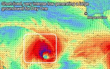
We're set for a cracking opening day of the waiting period before onshore winds set in.
Trouble Shooter // The Five Fin Surfboard
Muzz explains the "each way bet" shapers have when they throw five fin boxes into a board.
A Return To Caloundra Bar?
Hoping to stop erosion, authorities are dredging Bribie Island, but will the bar ever return?
Lifeline Surf Classic Returns to Queenscliff Beach
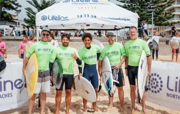
The Lifeline Surf Classic is back for its eighth year.
Comments
TEST comment
TEST comment